


US State of Maine
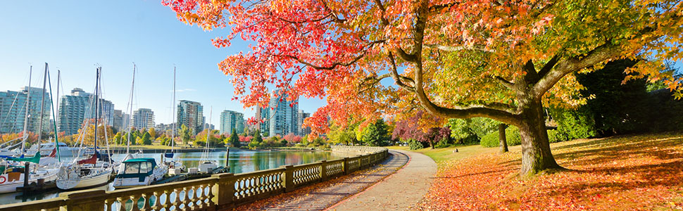
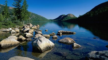
Maine is a state in the New England region of the northeastern United States, bordered by the Atlantic Ocean to the east and south, New Hampshire to the west, the Canadian provinces of Quebec to the northwest and New Brunswick to the northeast. Maine is both the northernmost and easternmost portion of New England. It is known for its scenery—its jagged, mostly rocky coastline, its low, rolling mountains, its heavily forested interior, and picturesque waterways—as well as for its seafood cuisine, especially lobsters and clams.
To the south and east is the Atlantic Ocean and to the north and northeast is New Brunswick, a province of Canada. The Canadian province of Quebec is to the northwest. Maine is both the northernmost state in New England and the largest, accounting for almost half the region's entire land area. Maine is the only state to border exactly one other state (New Hampshire to the west).
Maine is the easternmost state in the United States both in its extreme points and its geographic center. The municipalities of Eastport and Lubec are, respectively, the easternmost city and town in the United States. Estcourt Station is Maine's northernmost point, as well as the northernmost point in New England. (For more information see extreme points of the United States).
Maine is the least densely populated U.S. state east of the Mississippi River. It is called the Pine Tree State; nearly 90% of its land is forested. In the forested areas of the interior lie much uninhabited land, some of which does not have formal political organization into local units (a rarity in New England). The Northwest Aroostook, Maine unorganized territory in the northern part of the state, for example, has an area of 2,668 square miles (6,910 km2) and a population of 10, or one person for every 267 square miles (690 km2).
Maine is in the temperate broadleaf and mixed forests biome. The land near the southern and central Atlantic coast is covered by the mixed oaks of the Northeastern coastal forests. The remainder of the state, including the North Woods, is covered by the New England-Acadian forests.
Maine has almost 230 miles (400 km) of coastline (and 3,500 miles (5,600 km) of tidal coastline). West Quoddy Head is the easternmost piece of land in the contiguous 48 United States. Along the famous rock-bound coast of Maine are lighthouses, beaches, fishing villages, and thousands of offshore islands, including the Isles of Shoals, which straddle the New Hampshire border. There are jagged rocks and cliffs and many bays and inlets. Inland are lakes, rivers, forests, and mountains.

Schools in Maine
Public schools are run by one of four types of school districts: 1) local for a single school; 2) School Union whose members share only a superintendent; 3) School Administrative District containing multiple towns and one superintendent; and 4) Community School District that has one elementary school that towns share.
Private schools are less common than public schools. A large number of private elementary schools with under 20 students exist, but most private high schools in Maine can be described as "semi-private." This means that while it costs money to send children there, towns will make a contract with a school to take children from a town or School Administrative District at a slightly reduced rate. Often this is done when it is deemed cheaper to subsidize private tuition than build a whole new school when a private one already exists.

